In general, people do not consider West Point as a paddling destination. The town is not on one of the quiet coves feeding into the Chesapeake Bay in Mathews County. Nor is it the pristine woods, marsh, and shoreline of York River State Park. The industrial persona and lack of a canoe and kayak outfitter would make any devout water rat look elsewhere for a good paddling adventure.
But, before you head out to Milford Haven or Taskinas Creek, a paddle trip on the lower Mattaponi River and West Point Creek should not be completely dismissed. The town does offer convenient businesses, fishing, maritime history, and wildlife viewing. With a little planning, the little town with the big paper mill is not a bad place to put your boat in the water.

The launch on West Point Creek behind the pharmacy (C) John Gresham
Where to launch
There are three launch areas that have ample parking for paddlers. Beach Point Park is a small strip of sand at the intersection of Main and 1st Streets. Parking is on the street. The launch is right on the confluence of the Mattaponi & Pamunkey Rivers (the York). Checking wind speed and direction is recommended here because this is very open water and can be unforgiving to inexperienced paddlers, canoeist in particular. Glass Island has a boat ramp maintained by the VDGIF. It has a great parking lot. But, when the Atlantic Croaker are running, many a paddler choose to avoid it on weekends and holidays due to motor boat traffic. But, the Mattaponi as a little more sheltered than the York at Beach Point. The lot at the launch behind the West Point Pharmacy is newer and well made. The launch its self is a large concrete and gravel slab that is covered in mud at low tide. Put in beside the slab to avoid the mess. Despite this hinderance, this is the best of the three places to start paddling.
Seahawks and shipwrecks
A few of the waterfront homes on the Mattaponi have well-kept piers. For years, there was a large pier at the end of Seventh Street which used to be the home of a seafood company and a couple of restaraunts. Hurricane Isabel dealt the structure a death blow with only pilings and one detatched section of pier left. For years, there has been talk of developing a marina in this area. As of yet, it is only talk.

The Lord Delaware Bridge from the mouth of West Point Creek (C) John Gresham
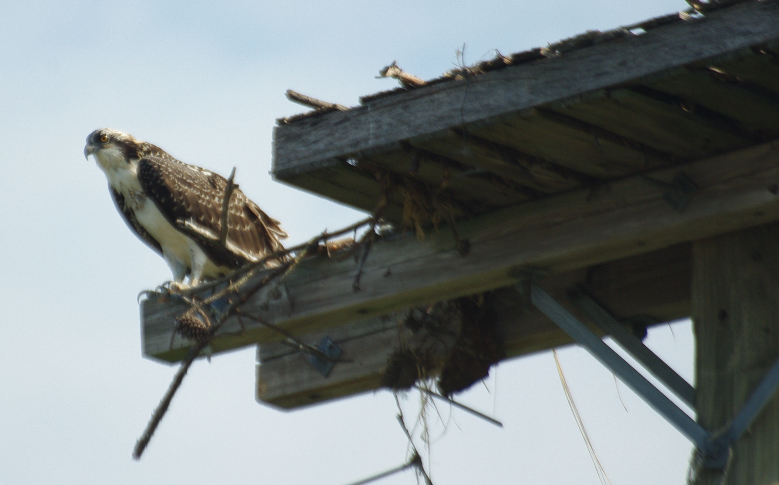
The Osprey have not waited for any construction to begin as a pair have occupied one of the pilings and built a nest as close to the water as I have ever seen. A similar nest is on the York just north of Beach Point Park. By having their nest so low to the water probably helps the birds with catching fish. Then again, I have seen Osprey spot a catfish in a bog from above the tree tops.

The Original Angry Bird (C) John Gresham
One form of structure that was not planned is a shipwreck. As the tide drops, two remains of boats can seen in the tidal flats. One was some sort of steam ship. The metal smoke stacks are the most prominent feature. The other may have been an older wooden structure. Further up river, there was a ship yard that was active during World War I.
Bridge and Trail
The Lord Delaware Bridge was constructed in 2005. It replaced the draw bridge that was lower to the water. When the Rockfish (Stripped Bass to most folks) are running, anglers wet their lines along the pilings, especially in the evenings when the lights shine on the water attracting baitfish. The approach to the old bridge still is intact. Bank fishermen take advantage of the location. There will even be some motor boat anglers anchored no further than a kid can cast.

West Point Creek flows into the lower Mattaponi River
The West Point Nature Trail/River Walk is a jewel of the town. It extends from the West Point Pharmacy parking lot along Chelsea Road to the elementary school. Bicyclist, joggers, and walkers share the trail. If you choose to paddle on a Thursday evening or Saturday Morning, stop by the Farmers Market at the corner of Chelsea and Glass Island Road for something fresh and local. Mixing a stroll with a paddle is not a bad idea for a full day of outdoor fun in town. Early morning views of the Mattaponi from the overlooks can be quite beautiful. You may wish to bring a camera for scenery and wildlife.
Creeping the Creek
West Point Creek is much like other streams that feed the upper York River with many twist and turns. Going downstream, there are a few houses on the creek with neighborly folk to greet. The confluence of the creek with the Mattaponi is quite broad and turns into a very shallow mud flat at low tide. At high tide, this is not a bad place to take beginning paddlers without worrying about deep water and strong currents.

Get the tide right to explore the creek (C) John Gresham
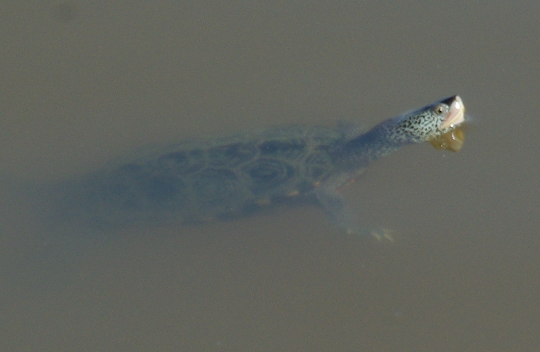
To go upstream past 14th street (Route 33) the tide must be low or going out in order to get under the bridge. On the other side, it is possible to disappear in the tidal marsh. Red-winged Blackbirds dominate here. But, Great Blue Herons can be found feeding on Fiddler Crabs and various Killifish. Don’t be surprised to see muskrat, raccoon, and snapping turtles swimming around. The headwaters of the creek can be crossed on Thompson Street in the Port Richmond area of town. But, there is, at least, one fallen tree that will keep you from paddling that far up. Do keep an eye on the tide. When it gets too low, you may get stuck in some places.
Planning a Paddle
The tide will determine where you launch from and how far you’ll go. I recommend the start of an incoming and top of the out going. A dead low tide will make for a muddy mess. Weekdays are better than weekends if you want to avoid a lot of boat traffic on the river. If you must go on a Saturday or Sunday, launch at the creek. When the York is at a dead calm, leaving from Beach Point is picture perfect at sunrise and makes a nice sunset trip if you paddle to the Pamunkey. Make sure you have the required safety gear for open water paddling and wear your PFD.

A natural escape in a small town (C) John Gresham